Subsurface Portal for ArcGIS
Integrate, manage share and analyze subsurface data on the web
Subsurface Portal for ArcGIS allows you to visualize complex subsurface information without the need for expert desktop software. By enhancing ArcGIS's capacity to manage geotechnical and geophysical data and situating them in a geospatial framework, the Subsurface Portal for ArcGIS empowers you to make informed decisions in development projects, while simultaneously minimizing potential risks and uncertainties.
The Subsurface Portal for ArcGIS seamlessly integrates with ArcGIS Enterprise, providing you with a powerfull geoscience platform that enables you to build applications and share data and findings across your organization, as well as with other project stakeholders.
Visualize
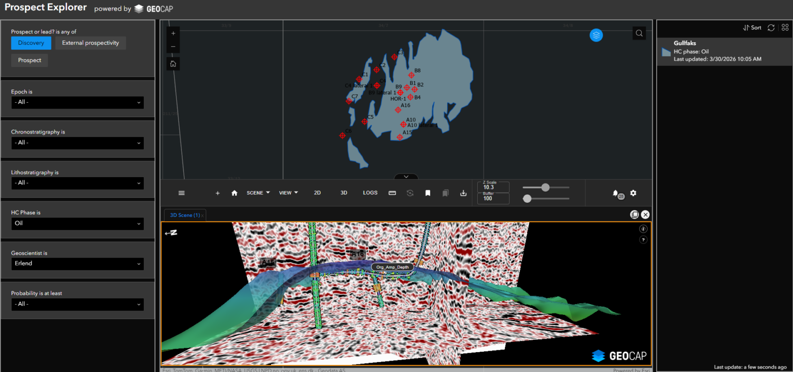
A wide range of visualization tools are available, including a powerful 3D viewer, a cross-section viewer, and a log viewer. These viewers can seamlessly integrate your GIS data with seismic data, borehole data, and interpretations, allowing you to gain valuable insights into the site characterization. With the ability to manipulate displays, measure distances, overlay map layers and rasters, and visualize proposed infrastructure, you can obtain a comprehensive view of the subsurface landscape. The interconnected viewers enable you to analyze data from different angles and perspectives, providing a holistic understanding of the subsurface geology.
Collaborate
Collaborating across disciplines is crucial for achieving successful outcomes in projects. One key element to achieving this is having a single source of truth that everyone can refer to. This helps to avoid confusion and ensures that everyone is working towards the same goals. With the ability to create and save compelling visualizations, important aspects of the project can be clearly conveyed to all stakeholders. The platform allows users to upload and visualize their own geospatial data, in a range of supported formats including Shape files, CSV, KML, GeoJSON, and map services. With this powerful tool at their disposal, teams can collaborate more effectively and achieve better results.
Fit for purpose web applications
The Subsurface Portal offers highly customizable web applications. Its subsurface viewer widget is seamlessly integrated with Experience Builder, which provides you with the flexibility to develop simple applications with pre-defined views and scenes or advanced applications allowing users to thoroughly interrogate and analyze the subsurface. The Subsurface Portal's versatility makes it an ideal tool for a wide range of users, from novices to professionals.
Technical Information
Subsurface Portal for ArcGIS consists of two components:
- A Server Object Extension (SOE)
- A custom Experience Builder Widget
In addition you will need one of the following products to import and publish data:
In order to run the products above you will need ArcGIS Pro 3.x and ArcGIS Enterprise 11.x with Portal for ArcGIS.
Supported formats
- 2D/ 3D SEG-Y
- 3D ZGY
- VDS
- AGS
- LAS
- Petrel software formats
- Kingdom formats
Price & Licensing
The Subsurface Portal for ArcGIS is licensed as an annual subscription license.
Related products
Ground Model for ArcGIS
Integrate, visualize and interpret geophysical and geotechnical data directly in ArcGIS Pro – trusted in offshore wind, oil & gas, and subsea projects.
GIS Data Link for Petrel™ subsurface software
Move data between Petrel and ArcGIS in both directions. No shapefiles. No manual reformatting.
Want to know more?
Get in touch