How Multiconsult streamlined offshore interpretation with Ground Model for ArcGIS
From energy to infrastructure, offshore projects rely on accurate subsurface interpretation. But com...
Plan routes, assess burial risk, manage seabed and subsurface uncertainty — and communicate it all clearly within your GIS.
From energy to infrastructure, offshore projects rely on accurate subsurface interpretation. But combining diverse datasets into one clear picture is no simple task.
Accelerate Interpretation. Deliver More Value.
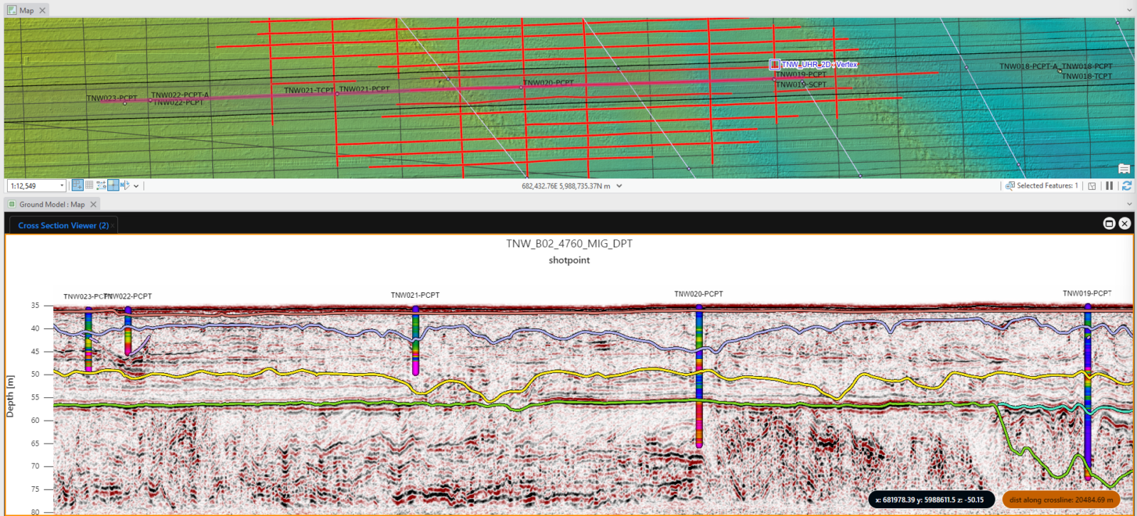
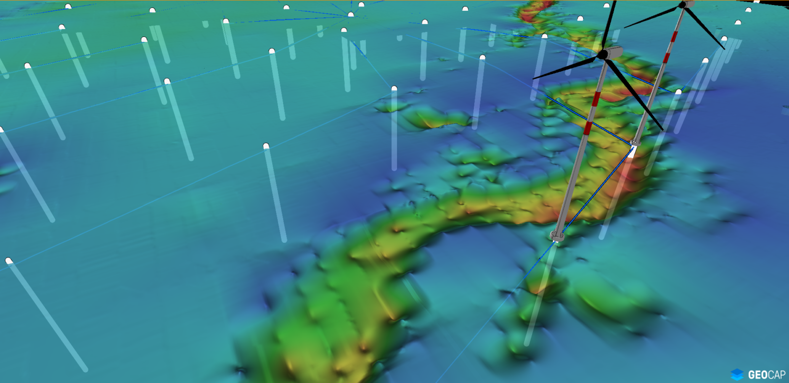
Assess Risk. Optimize the Route.
Go beyond interpretation. Understand shallow geology in true spatial context. Identify trenchability risks, refine routes, and align ground conditions with engineering tolerances, all within a single GIS environment.
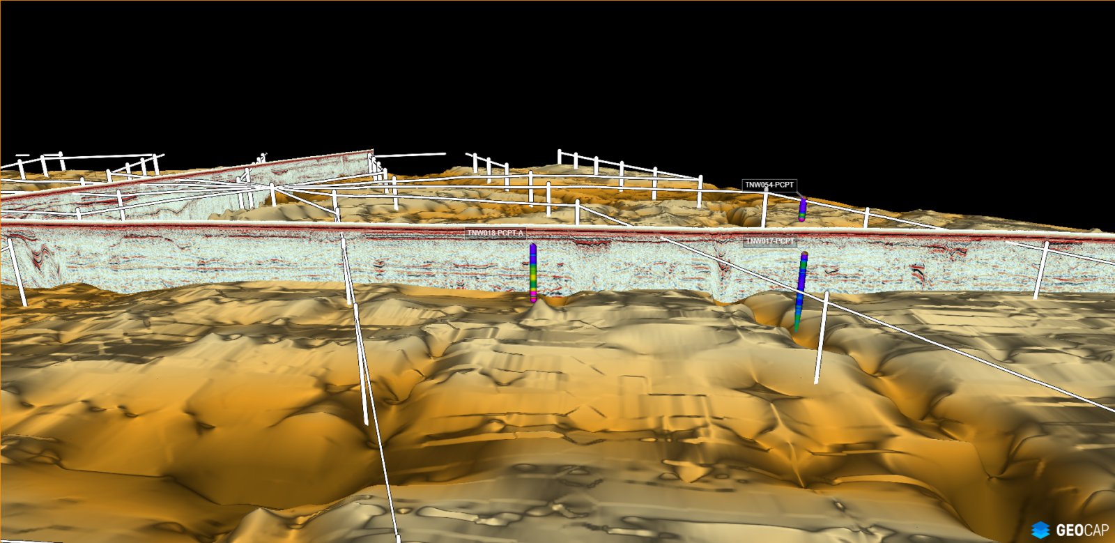
Share Insight. Communicate Clearly.
Ground models make complex subsurface data easier to understand. Share spatially aligned visuals and deliverables with surveyors, designers, installers, and stakeholders, reducing rework and aligning expectations.
The ArcGIS Pro add-in for smarter subsea cable planning.
From energy to infrastructure, offshore projects rely on accurate subsurface interpretation. But com...
Scottish Power view seismic data in ArcGIS to identify subsurface constraints...